Image:Ohio wells.gif
From Wikimarcellus
Ohio_wells.gif (50KB, MIME type: image/gif)
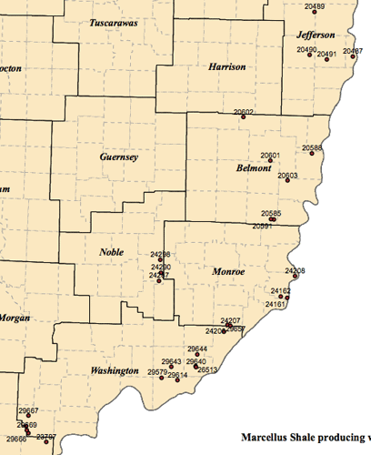
Ohio Marcellus shale wells as of June, 2010. Map courtesy of the Ohio Geological Survey.
File history
Legend: (cur) = this is the current file, (del) = delete
this old version, (rev) = revert to this old version.
Click on date to see the file uploaded on that date.
- (del) (cur) 00:42, 24 September 2010 . . Tcopley (Talk) . . 408x500 (51077 bytes) (Ohio Marcellus shale wells as of June, 2010. Map courtesy of the Ohio Geological Survey.)
- Edit this file using an external applicationSee the setup instructions for more information.
Links
The following pages link to this file:

